
Warum ist gerade jetzt diese Frage, ob die Erde flach ist oder doch ein Planet so interessant?
Sehr gutes Video!
WHY ZETETIC FLAT EARTH UN MAP IS CORRECT? Step by step common sense analysis.
IF THIS VIDEO DOESN’T PLAY —- IT IS ALSO AVAILABLE TO WATCH ON DAILYMOTION —- YOU MIGHT NEED TO DOWNLOAD THEIR FREE APPLICATION FROM THE GOOGLE STORE IF YOU’RE WATCHING ON YOUR TABLET — http://www.dailymotion.com/video/x2ka…
This is how I see it, step by step. This video also contains very important information about the flight paths of commercial planes between southern destinations and I highly recommend you watch it all. Real passengers of those flights say that the planes stop at certain locations to refuel. I’ll make another separate video about that very soon so please stay tuned. (I just don’t have time to finish it right now.) Also, very important thing proving the Flat Earth to look like UN map is the Solar Analemma and I made a separate video about that: https://www.youtube.com/watch?v=qNGnz… Cheers!
Please let me know if you have anything to add and if you agree with me. Happy watching and enjoy! Greetings.
Please note, that regular/average people will never be able to find out how the Flat Earth really looks like – if it’s a square, a triangle, or a circle, and how big is it. We will never know that. We can only make some assumptions based on certain facts of reality that we already know and have an access to – our observations and data gathered by independent researchers and I will post that in details in my next video. So far what we know is that Polaris is stationary, North is North, South is South, nobody has access to Antarctica, yet planes fly over the Arctic and are prohibited to fly over the Antarctic, the distances between continents below equator are much larger and the commercial airplane flight paths confirm that the Earth map model with the Arctic in its center as the true North is the correct map, the UN version or 1892 New Standard Map of The World. People already knew back in 1892 how the Earth really looks like and how it works. So, this knowledge has been intentionally suppressed to us by authorities and replaced with Heliocentric model of ball Earth that rotates with more than the speed of sound around the enormous in size Sun. There is no doubt about it. All Google Maps are controlled by the CIA, the media is in hands of few people, etc. So, they will show us whatever they want us to see. That’s why we have to use logic and just constantly analyze information provided to us by authorities.
~~~
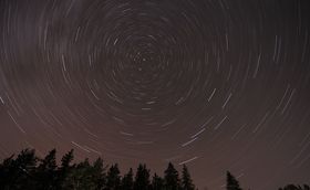
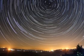
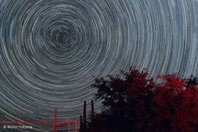
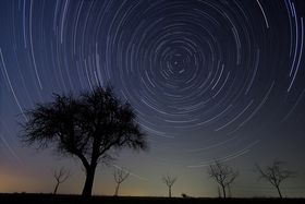
Wieso kreisen alle Sterne um den Nordpol, wo sich doch angeblich die Erde dreht und nicht der Himmel?
Solche Fotos kennt garantiert jeder!
Auch ich habe diese mehrmals gesehen, wer hat sie genau hinterfragt, wie es dazu kommt? In obigem Video gibt es dazu eine Erklärung auch solche Bilder werden gezeigt, diese hier, habe ich aber extra aus Fotocommunities und willkürlichen Seiten genommen.